"PrecisionTrack: Revolutionizing Vehicle Tracking with GPS and GPRS Technologies"
Introduction
Our cutting-edge project focuses on revolutionizing vehicle tracking through the integration of state-of-the-art GPS and GPRS technologies. By equipping each vehicle with a GPS tracking unit, we ensure real-time tracking capabilities that provide accurate longitude and latitude coordinates. These data points are seamlessly transmitted to a centralized database using GPRS modems, enabling swift and reliable communication.
Our innovative system goes beyond basic tracking functions by incorporating advanced .NET-based software that visualizes and marks the vehicle's precise location on Google Maps.
This dynamic feature transforms our solution into a comprehensive, real-time tracking platform that is both user-friendly and highly efficient.
Not limited to just vehicles, our adaptable system can be easily customized to track various assets or individuals by simply attaching a GPS unit. This flexibility makes our project a versatile and invaluable tool for a wide range of industries and use cases.
With a strong emphasis on accuracy, reliability, and user-friendliness, our project is poised to revolutionize the way tracking systems operate. By leveraging cutting-edge technologies and innovative software, we are paving the way for a new era of efficient and effective tracking solutions.
From fleet management to personal tracking, our project caters to a diverse set of needs and requirements, making it an essential tool for any organization or individual looking to optimize their tracking capabilities. Join us on this exciting journey as we redefine the future of tracking technology.
Applications
The vehicle tracking system developed in this project has a wide range of potential application areas due to its ability to leverage GPS and GPRS technologies for real-time location tracking. In the transportation sector, this system could be utilized by logistics companies to optimize fleet management, monitor vehicle movement, and improve delivery efficiency. In the public transportation sector, it could enhance passenger safety and provide real-time updates on bus or train locations. In the field of emergency services, such as ambulance or police dispatch, the system could help in quick response times by tracking and directing nearest vehicles to emergencies. In the construction industry, tracking machinery and equipment could prevent theft and improve asset management.
Additionally, the system could be used for personal safety, such as tracking elderly individuals or children for caregivers. Overall, the project's features and capabilities make it a valuable tool for a diverse range of industries and sectors where real-time tracking and location data are essential.
Customization Options for Industries
This vehicle tracking system project offers a multitude of customization options to cater to various industrial applications. One sector that could greatly benefit from this project is logistics and transportation. Companies in this sector can utilize the system to monitor their fleet of vehicles in real-time, optimize routes, enhance delivery efficiency, and improve overall fleet management. Another potential sector that could benefit is the construction industry, where equipment and machinery can be tracked to prevent theft, monitor usage, and improve maintenance scheduling. Additionally, the system can be adapted for use in emergency services to track the location of emergency vehicles and respond more effectively to incidents.
The project's scalability and adaptability make it suitable for a wide range of industries, allowing for customization to meet specific needs and requirements. Its real-time tracking capabilities and integration with Google Maps make it a versatile solution that can be tailored to fit the unique demands of different industrial applications.
Customization Options for Academics
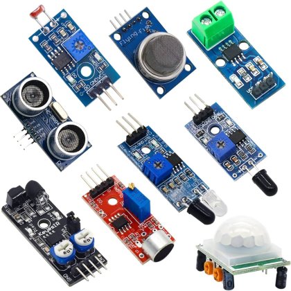
This project kit can be a valuable tool for students to gain hands-on experience with advanced technologies such as GPS, GPRS, and .NET software development. Students can utilize the kit to learn about the principles behind vehicle tracking systems and practice designing and implementing their own systems. By customizing the system to track different assets or individuals, students can develop a deeper understanding of how these technologies can be applied in various real-world scenarios. For example, students could create a personalized tracking system for a school bus fleet, a delivery service, or even for tracking wildlife in a research project.
This project kit offers a wide range of modules and categories that students can explore, allowing them to build their skills in programming, data analysis, and system integration while working on engaging and practical projects in an academic setting.
Summary
Our project revolutionizes vehicle tracking with advanced GPS and GPRS technologies, ensuring real-time tracking and precise location visualization on Google Maps. This versatile system can track vehicles, assets, or individuals, catering to industries like fleet management, public transport, emergency response, and personal vehicle tracking. With a focus on accuracy, reliability, and user-friendliness, our project offers an efficient and effective tracking solution for diverse needs. By integrating cutting-edge technologies and innovative software, we are reshaping the future of tracking technology, making it an essential tool for organizations and individuals looking to optimize their tracking capabilities. Join us on this transformative journey.
Technology Domains
nan
Technology Sub Domains
nan
Keywords
vehicle tracking system, GPS technology, GPRS technology, GPS tracking unit, real-time location data, centralized database, .NET software, Google Maps, real-time tracking solution, asset tracking, individual tracking, GPS unit attached
| Shipping Cost |
|
No reviews found!







No comments found for this product. Be the first to comment!